Israeli F16 Flightplans


Re: Israeli F16 Flightplans
Giorgio is correct, sometimes in FS you just cannot do real and have to cheat a little. With this AFD if the hold points were put in the correct places, the F16 burners would be on before they reach the runway.
Mark
Re: Israeli F16 Flightplans
I'm cool with what Giorgio has done and if that is a limitation of FS9 so be it.I appreciate everything that people produce, it was only an observation.
Regards Paul Day.
Regards Paul Day.

-
petebramley

- MAIW Developer

- Posts: 1545
- Joined: 17 Jun 2007, 16:05
- Version: P3D
- Location: EGBG
Re: Israeli F16 Flightplans
Hi Bismark
I have a small problem with LLHS and don't seem able to get rid of it

As you can see there seems to be a whopping great tank in the midddle of the runway.
I opened it up in ADE to try and remove it but to no avail. Do you have any ideas as I'm stumped

I have a small problem with LLHS and don't seem able to get rid of it
As you can see there seems to be a whopping great tank in the midddle of the runway.
I opened it up in ADE to try and remove it but to no avail. Do you have any ideas as I'm stumped
Pete B
Retired and busier than ever !!
Retired and busier than ever !!
Re: Israeli F16 Flightplans
I really don't know. 
It seems to be a default object.
Usual questions?
Have you deleted the indicated files? Have you got some other scenery in that zone?
Last chance, try to draw an excluding polygon in that zone with ADE.
Anyone else with the same problem?
Giorgio
It seems to be a default object.
Usual questions?
Have you deleted the indicated files? Have you got some other scenery in that zone?
Last chance, try to draw an excluding polygon in that zone with ADE.
Anyone else with the same problem?
Giorgio


Re: Israeli F16 Flightplans
Nope not in mine...
-
petebramley
- MAIW Developer
- Posts: 1545
- Joined: 17 Jun 2007, 16:05
- Version: P3D
- Location: EGBG
Re: Israeli F16 Flightplans
Problem solved 
I had a systematic check through my scenery files and narrowed it down to the following:
The following file: Tank 2.bgl
Which lived in a scenery folder "KMSY New Orleans V2\Scenery"
The Scenery was by a guy called Glenn Johnson and I downloaded it originally sometime in 2006.
Phew
I had a systematic check through my scenery files and narrowed it down to the following:
The following file: Tank 2.bgl
Which lived in a scenery folder "KMSY New Orleans V2\Scenery"
The Scenery was by a guy called Glenn Johnson and I downloaded it originally sometime in 2006.
Phew
Pete B
Retired and busier than ever !!
Retired and busier than ever !!
Re: Israeli F16 Flightplans
Ok people, thi is my 1.000th post on the forum  (...and my 48th birthday...
  )
)
Once again, thanks to all of you. This is a fantastic place and I'm proud to be part of it.
So, to celebrete this event, here is the third base of this project.
Ramat David Air Base - LLRD
Same libraries used as in the previous bases, plus Saint Dizier Bums.
Hope you like it.
Giorgio

Once again, thanks to all of you. This is a fantastic place and I'm proud to be part of it.
So, to celebrete this event, here is the third base of this project.
Ramat David Air Base - LLRD
Same libraries used as in the previous bases, plus Saint Dizier Bums.
Hope you like it.
Giorgio

-
ardethomas
- First Lieutenant

- Posts: 178
- Joined: 03 Jan 2007, 22:18
- Version: FS9
- Location: San Juan,PR
Re: Israeli F16 Flightplans
Finally Israeli airbases!
They look great.
Thank you.
On Google Earth there is an airfield near Hatzerim called Hatzerim Northwest, is it on the to do list?
Thanks again!
They look great.
Thank you.
On Google Earth there is an airfield near Hatzerim called Hatzerim Northwest, is it on the to do list?
Thanks again!

Re: Israeli F16 Flightplans
Thank you and Happy Birthday!!!!
Fred
Fred
Re: Israeli F16 Flightplans
Love the detail you put in to your AFD's Giorgio. Happy Birthday for yesterday also.bismarck wrote:Ok people, thi is my 1.000th post on the forum
Once again, thanks to all of you. This is a fantastic place and I'm proud to be part of it.
So, to celebrete this event, here is the third base of this project.
Ramat David Air Base - LLRD
Same libraries used as in the previous bases, plus Saint Dizier Bums.
Hope you like it.
Giorgio
Mark
Mark

Re: Israeli F16 Flightplans
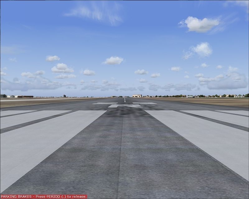
Hi Giorgio,bismarck wrote:
Congrats on your birthday and your 1000th post!
I haven't had time yet to have a close look at the AFD, but from what I can tell from the screenshot (and screenshots of other AFD's by you), I would give you the advise to move your hold short nodes a little further away from the runway as in real life. Aircraft holding at the edge of the runway or even on the underrun will look very unrealistic. Remember that the red circle around the hold short node only needs to slightly cross the runway edge, not the edge at both sides, the centreline or start point.
Your runways also seem a little too short which probably leads to the holding positions on the underruns. In case of RWY26 here for exampe, the threshold should be at the beginning of the asphalt and you then could easily move the hold short nodes onto the intersecting taxiways as in real life.
Other than that, as Mark said, I also like the amount of detail you put into your AFD's. Keep up the good work!
-
Makadocias

- Captain

- Posts: 385
- Joined: 12 Aug 2006, 09:41
- Version: FS9
- Location: Alkmaar, EHAM @work
- Contact:
Re: Israeli F16 Flightplans
Thank you Giorgio and Happy Birthday!!!
Check out my pic's at
http://www.airliners.net/search/photo.s ... entry=true
My video's at
http://www.youtube.com/user/Makadocias/videos
http://www.airliners.net/search/photo.s ... entry=true
My video's at
http://www.youtube.com/user/Makadocias/videos
-
phantomfreak
- Major

- Posts: 674
- Joined: 10 Sep 2009, 18:50
- Version: FS9
- Location: KMEI
Re: Israeli F16 Flightplans
One question about Ramat David LLRD, I was checking the runways against World Aero Data and the runways are off from there actual positions. Is this due to the runway positions for the default airports?
The runways by World Aero Data are 09/27, 11/29, and 15/33.
The runways by World Aero Data are 09/27, 11/29, and 15/33.
Bazinga!
Re: Israeli F16 Flightplans
No, the default airport is not the problem.
When I make these airports I take an image of the area from Google Earth and insert the image in ADE. I make the airport over this image.
With LLRD I noticed that the image was not correctly aligned with the real image from Google, but I was alredy at an advanced stage of the work. Don't know why there is this difference, it never happened before, nor it's happening now with the upcoming LLEK.
Sorry for that, but this is what I can do.
Regards, Giorgio
Re: Israeli F16 Flightplans
Hi all, this time I can't sort out the problem, so here I am for any suggestion or solution from the experts.
I'm working on Tel Nof - LLEK. As in the other previous three bases created in Israel, there is a zone in the airfield that disappears, as you can see in the screenshot.

In the other bases, I sorted out the problem drawing a grid of taxiways path in the interested zone. I have made the same in this case (as per screenshot below), but I can't sort it out

The green zone that you can see in the shot, is a Flatten Polygon created with ADE.
Here the tests done:
Drawing of the grid of taxiways path
Drawing of the Flatten Polygon
Change airport altitude from 192.999 ft to 192 ft (also disappears a portion of the runway)
Change airport altitude from 192 ft to 193.5 ft (runway re-appears but problem persist)
Is there someone who can help me in this?
Thanks in advance, Giorgio
Re: Israeli F16 Flightplans
Delete one of the double vertexes in the area I marked and look for possible others.
From the ADE9x Manual:
From the ADE9x Manual:
If any of a polygon's segments cross over each other, thus forming two ore more separate enclosed areas, only one of the enclosed areas will be filled in and the actual shape of the apron surface will be unpredictable.
Re: Israeli F16 Flightplans
Greg, from now on your name is "Hawkeye"  , that was the problem.Thank you. very very much.
I owe you a beer!
Giorgio
I owe you a beer!
Giorgio